An Introduction to GPS – Global Positioning System
The GPS or “Global Positioning System” is a system for calculating position from signals sent by a network of satellites.
The satellites orbit and the earth is in a geosynchronous orbit, at an altitude of 20.2 km, forming a constellation of satellites, so that at least 4 of them are visible from any point on the planet.
The satellites transmit a high-frequency signal containing information packets with precise time at which each is transmitted. Receivers pick up the signal and use a system of trilateration to compute the position, comparing the time difference between transmission and reception of each packet, thereby calculating the distance to each satellite. As you move, the distance from the satellites changes, generating a small difference in the time course, which is used to update the location.
The receiver gets signal from three satellites to calculate a position (latitude, longitude and altitude) and the signal from 4 satellites is also possible to calculate the altitude, providing the 3D view.
In space, the signal propagates at a speed close to the speed of light, so that it takes just a few fractions of a second to traverse the distance between satellite and receiver. Inside the atmosphere, the speed is a bit lower, since the ionosphere and atmosphere cause a slight delay in signal propagation in relation to the speed of light (a phenomenon dubbed by the ionospheric delay), a difference that is taken into account when calculating position.
As you can imagine, to make the system work, it is necessary to equip satellites with very accurate clocks, since a difference of a thousandth of a second would be enough to cause an error of almost 300 km in the position calculation. Even a small delay of only a microsecond would cause a deviation of 300 feet, which would not be acceptable.
An example of the accuracy of the system is that the satellites need to be adjusted in a few fractions of a second periodically to correct small deviations arising from the gravitational difference between the clocks on Earth and in space. As predicted by the law of relativity, clocks run ashore subtly slower than clocks in orbit, due to the difference in gravitational force to which they are exposed (the stronger the gravity, the clocks run more slowly), a difference of 45.9 microseconds per day, which would compromise the accuracy of the system if not corrected.
In the case of satellites, the solution is to use atomic clocks, which are combined with an elaborate system coordinated by adjusting ground stations. Of course, it would not be possible to use atomic clocks in the receivers too, so the designers developed a simple and ingenious solution: when turned on, the receiver synchronizes its clock with a satellite, just using the time included in the packages. This allows receivers to use quartz crystals (as used on motherboards and other electronics), which are cheap and accurate enough for the task.
Like many other technologies, the global positioning system arose purely for military purposes, but over time ended up being open for civilian use. Initially, the signal was deliberately degraded, which caused the error margin stayed above 100 meters. Only the military had access to the codes needed to correct the deviation and use the system with maximum precision.
The first GPS receivers were much simpler than today, they provided only the latitude and longitude position, the rest was on account of the user who needed to calculate the map. The next generation brought simplified maps, displayed in monochrome screens, but with the evolution of controllers and falling prices on color screens, flash memory and other components, they evolved rapidly, until the models we have today.
Current models match the location and coordinates with digital maps and 3D software that calculates the position on the map, offering directions and voice guidance. Although the signal emitted by GPS satellites is available to anyone wishing to use, the appliance manufacturers offer additional services such as traffic information (obtained using a data connection), updates the maps and so on, usually charging a monthly subscription or by annual subscription.
We can say that 25% of the cost of a GPS device is to match current basic circuits that compute and coordinates, the remaining 50% for hardware (processor, memory, screen, etc..) And the remaining 25% for the software and additional services.
With the miniaturization of components, it made sense to include GPS receivers in smartphones by leveraging the screen, processor, memory and other components. The first handsets with integrated GPS were very expensive, often costing more than buying a smartphone and a GPS separately. However, over time, prices have dropped to the point of passing the GPS add little to the final cost of the device and become standard in more expensive devices.

Although the screen is smaller and the set is often less convenient to use than an automotive GPS, the smartphone has an advantage, which is, you can always take your smartphone with you, avoiding the risk of theft by leaving the GPS inside the car. Even devices without GPS can play the role of browsers with the help of an external GPS receiver, connected via Bluetooth.
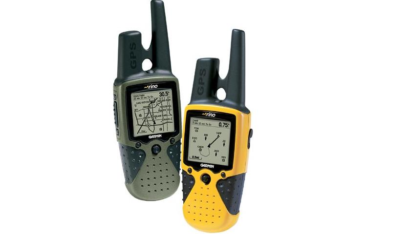
Further, there are differences between the different models of receivers. Initially, the main characteristic was the number of channels supported. The first supported only four channel receivers (the exact number necessary to calculate the 3D coordination) but already emerged models with 5, 6, 8, 12, 16, 20, 32 or even 54 channels, generating a race similar to the arms existed at the time of the multimedia kits.
The number of channels of the satellite receiver determines how it is able to simultaneously monitor. Most current models offers channels 12-20, which is more than sufficient, considering that most of the time, only nine or ten satellites are visible and only four are required to calculate the 3D position.
The spare channels allow the receiver to monitor the satellites and use them to calibrate the position, subtly improving accuracy. However, the “physical” limit is still the number of visible satellites, which currently is never more than 12 in any part of the world. Thus, from 12 channels, it no longer makes any difference whether the receiver supports 20, 32 or 500 channels, as only 12 will be used.
For anyone who has a smartphone without GPS, have the option of using a Bluetooth GPS receiver. They are also very compact, almost always smaller than an average cell phone:

They can be combined with a PC or notebook (you can use the GPS in conjunction with Google Earth software or other location), but the most common is to combine them with a smartphone that coordinates and handles other operations, running software with maps and giving directions. Everything is processed by the smartphone, from the coordinates calculated by the GPS receiver. Using one of these receptors and installing a navigation software, your smartphone will offer functions equivalent to a device with integrated GPS.
Although carrying a separate GPS receiver is uncomfortable, but they offer a great advantage, which is that they are independent. This allows you to keep the same receiver when changing device, different models with integrated GPS.
Back to the configuration, the first step is to make pairing between the smartphone and the receiver. As in the case of Bluetooth mice and keyboards, they use a passphrase fixed (“0000” on many models), specified on a label or in the manual.
In general, smartphones utilize GPS antennas smaller and less sensitive and / or GPS chipsets built with fewer resources. To reduce the difference of sensitivity and allow the satellite fix is obtained quickly, even with the weakest reception, they use a hybrid system, A-GPS (Assisted GPS) satellites, where the signal is combined with the use of cellular triangulation and the use of a remote server, which provides information about the positioning of satellites (drastically reducing the time required to obtain the fix) and other information that facilitate the work of the receiver.
Of course, all information is transmitted using the cellular network, but the volume of data transferred is small, only a few kbytes per query.
Of course, the A-GPS is not perfect and is subject to various bugs and errors, which, combined with the use of traffic data, makes some choose to disable the feature. However, in most cases the balance is highly positive, since the A-GPS makes the use of GPS well as avoiding that you have to wait for several minutes to fix the satellites.
There are different GIS Solutions for commercial use and also free options like Google Maps.
Use your smartphone as a locator instead automotive GPS because it has its pros and cons. The big advantage is the fact that you have it always available, which means that you end up using in many situations otherwise would not have a GPS handy. Another advantage is the cost, since the price difference between a smartphone with GPS and without an equivalent (or a separate USB receiver) is much lower than the price of a full browser. A third advantage is the issue of software, since you can choose the smartphone as per your choice.
- Achieving Secure, Reliable Compliance with India’s Data Sovereignty Mandates - November 17, 2025
- Implementing GPU workloads in critical government application - November 12, 2025
- Why the BFSI Industry Needs GPUaaS Now - October 31, 2025