GIS Applications in Utility Sector
The utility sector is one of the expanding sectors. And utility management is one of the basic needs of modern infrastructure management. The investment made on different utility supply lines ex. Water, sewage, power lines telephone lines, and gas mains. So components of utility should be functional without any breakdown. And it very difficult to manage it manually, so geographic data provides spatial dimensions to its management.
Most of the case GIS maps of inferior quality without any documentation. Efficiency, environment protection, and supply require good quality basic data. Reliable geospatial and location information of underground utility lines is helpful for avoiding excavation damages. The GIS-based utility mapping system is also important in the repair and replacement of utility lines because of correct locational data. GIS modeling use for certain utility management, in the future all utility plans will be GIS-based.
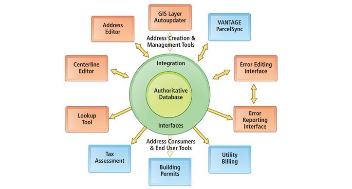
In the GIS database, integrated information is stored, and also a database with functionalities of query making, statistical analysis with visualization capability, and geographic analysis is the advantage of GIS maps. So we can recognize that GIS mapping is beneficial in utility management and information system. Satellite images and aerial photographs (i.e. Remote sensing data) are useful for digitization, analysis of networks and utility assets. This technology is useful for the correct representation of the infrastructure as well as geospatial information used in the management system.
Through GIS actual distribution of utility lines can possible to show. And it can possible to represent with roads, buildings, and land ownership boundaries.
GIS techniques are ideal in terms of various aspects, representing infrastructure of utilities, problem identification with providing a solution, in maintenance, technical problems, designing efficient meter reading. Successful utility management is possible by using GIS techniques. GIS maps are important in the management of underground utilities.
GIS is useful for the management of daily operations of various utilities. It is useful for modeling utility data with integration from other sources, i.e. satellite data, attribute information. GIS database with topology is beneficial in utility services as a power outage, main breaks, and service stoppages.
GIS useful in utility projects
1. Telecommunications:
The telecommunication industry rapidly expanding. For business growth company should know where their facilities and customers exist. Also, locational information about this data is useful. GIS database can have the potential to work on these queries.
2. Water and wastewater utilities:
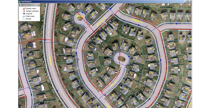
Integrating data from various sources and with geospatial data one manageable system is formed by many water and wastewater utilities. This system can be beneficial for the management of the flow of wastewater to businesses and service homes by tracking the location of water and meters, hydrants, valves. In the Maharashtra government implementing Sujal and Nirmal Abhiyan Yojana, in this project consumer survey, water and energy examination, flow meter installation, hydraulic modeling, and GIS mapping components included. Water flow connectivity and associated consumers can identify through maps is an advantage of this GIS-based project.
3. Electricity Mapping:
Geographical Information System (GIS) and Remote Sensing (RS) technologies are very important in electricity mapping projects.
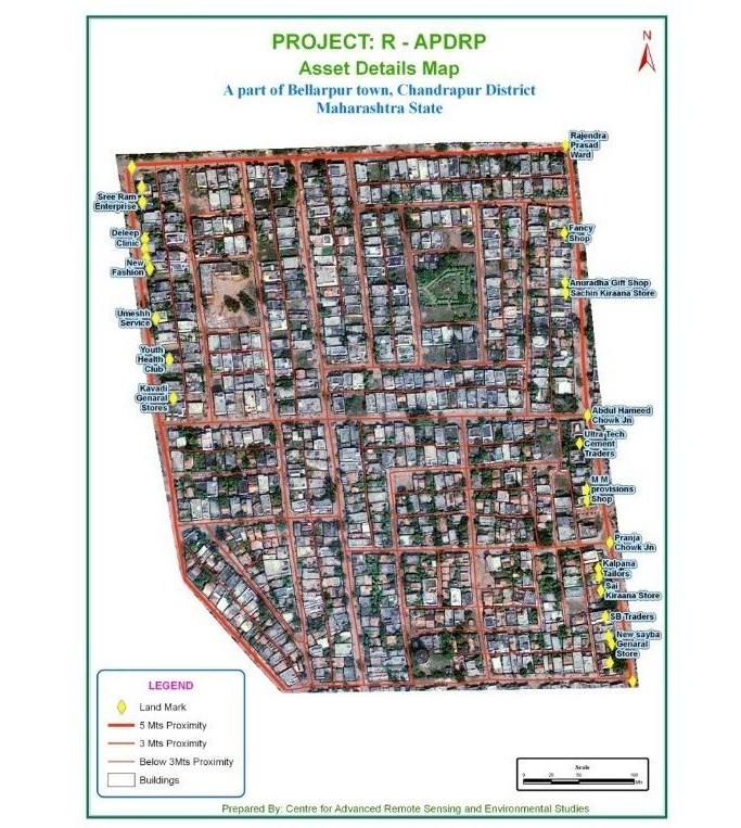
Restructured Accelerated Power Development & Reforms Programme (R-APDRP) project is a central government project implemented in the whole country. It includes preparation of Base-line data for the project area including indexing of the consumers, Mapping through GIS, and Metering of Distribution Transformers and Feeders. Mapping of all electricity assets and the distribution of the network over the entire assigned geography.
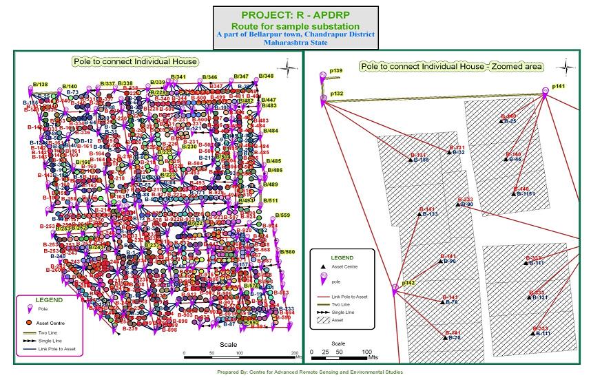
Collection of geospatial data of distribution network of electricity lines (i.e. HT-High tension line and LT-Low tension lines) which required DGPS survey and door to door consumer survey. In this, mapping of all electrical assets with electricity network distribution information using GIS techniques. So this project useful to me for the actual location of the poles, electricity lines, and actual consumption of the electricity. So due to this utility project good revenue generated in MSEB, also gathered correct locational and actual informative data. Using modems this electricity management system application is made live application.
Finally, we conclude that GIS mapping is very advantageous in the management of the utility sector.
- Achieving Secure, Reliable Compliance with India’s Data Sovereignty Mandates - November 17, 2025
- Implementing GPU workloads in critical government application - November 12, 2025
- Why the BFSI Industry Needs GPUaaS Now - October 31, 2025