
GIS & RS Applications in Forestry
Natural resource management involved in the forestry sector. Currently many states, and private forestry agencies, governments are implemented Geographic Information Systems (GIS) and Remote Sensing (RS) for various applications. Mainly supporting analysis, assessment, and management of our forests.
Wildfire management, private land regulation, and public land management are done by different forest organizations and agencies. And so their major work part contributes to the nation’s governance. They assist in public land management, they have a major role in the government of any nation. Nations state forestry organizations using geospatial data for their operations. Geographic data with spatial dimensions is useful for understanding ground conditions, also useful for strategic decisions. Spatial data is very important to foresters for conservation and prevention planning of the forest, its management, and for global forest’s future conditions.
Remote sensing technology, panchromatic and multispectral satellite image data processing operations involve georeferencing of the image, haze removal, and image enhancement techniques, pan-sharpened image, color balancing techniques is very useful for analyzing change detection and mapping of the land cover of the forest, culture data extraction, classification of lithology, Classification of NDVI (Normalized Difference Vegetation Index) and mapping of it, Urbanization (monitoring of the urban growth) is also beneficial for emergencies monitoring.
GIS & RS Applications in Forestry
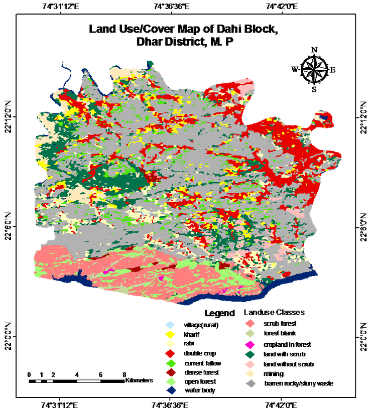
GIS and RS technology is important in forest cover mapping.
- Multilayered site representation can be possible by using elevation (ex. slope), hydrology and the locational information of roads and infrastructure this interpreted data of large areas can useful for Emergency and Fire mapping. And forest fires are directly affected by plants, animals, vegetation cover, streamflow, soil, air quality, and climate. The loss the life and property also caused by the loss of timber. Forest fires also responsible for wildlife habitat destruction. GIS useful for forest fire modeling obtaining timely and efficient geospatial information for the management of forest fires
- GIS data useful for forest management, because most of the rainforests are depleting at an enormous rate, and it is due to the increasing rate of urbanization and agriculture and this human activities encroachment in forest areas.
- Deforestation Identification using different RS data i.e. different multispectral imageries with GIS maps of the urban growth and factor recognition affecting deforestation. Also, Different temporal satellite image data can provide statistical analysis of forest cover and information about deforestation using GIS maps.
- GIS is useful for representation in the form of graphs, maps, and other GIS statistical modeling functionalities aid its value. So it is useful for forest management
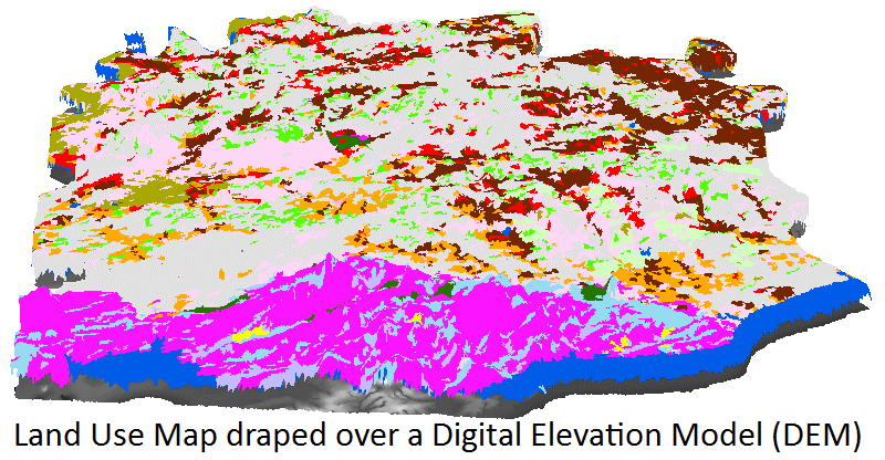
- DEM (Digital Elevation Data) of forest cover useful for GIS analysis. And it is useful for various terrain attributes examination, movement of soil and nutrients influence from it, as well as the resulting outcome on wildlife productivity, forest, plant distribution.
We can conclude that GIS and RS data is a very valuable resource for Forest Management and Monitoring.